
 Français
Drone photogrammetry service
From now on, with drone photogrammetry it is possible to modelise an area in 3D (buildings, construction site, quarries, etc.)in order to draw plans, measures and calculations (length, surfaces, volumes). You can then access to very high resolution cartographic photogrammetry.
This development therefore offers new opportunities in sectors such as measurement, technical audit and research (land surveyors, topographers, archeologists, building trade, architects, cartographers, manufacturers, etc.). It also permits drone operators to offer clients with innovative services at a very high value added.
HOW DOES IT WORK?
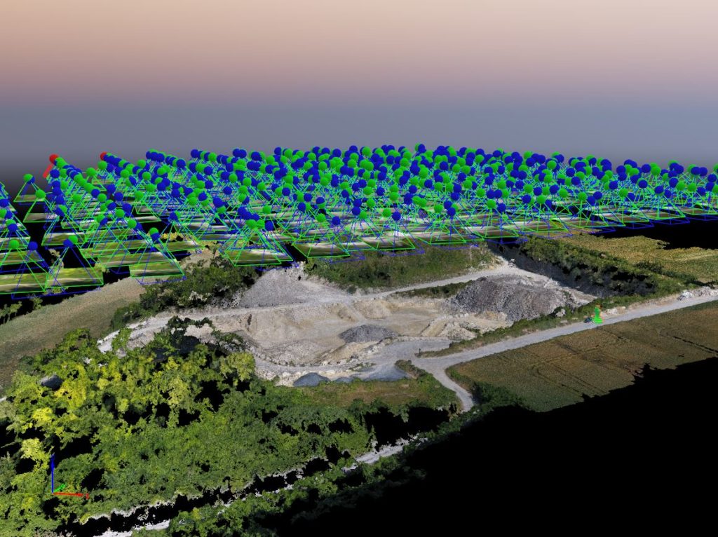
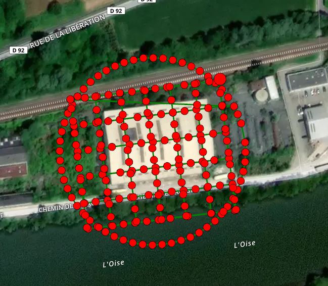
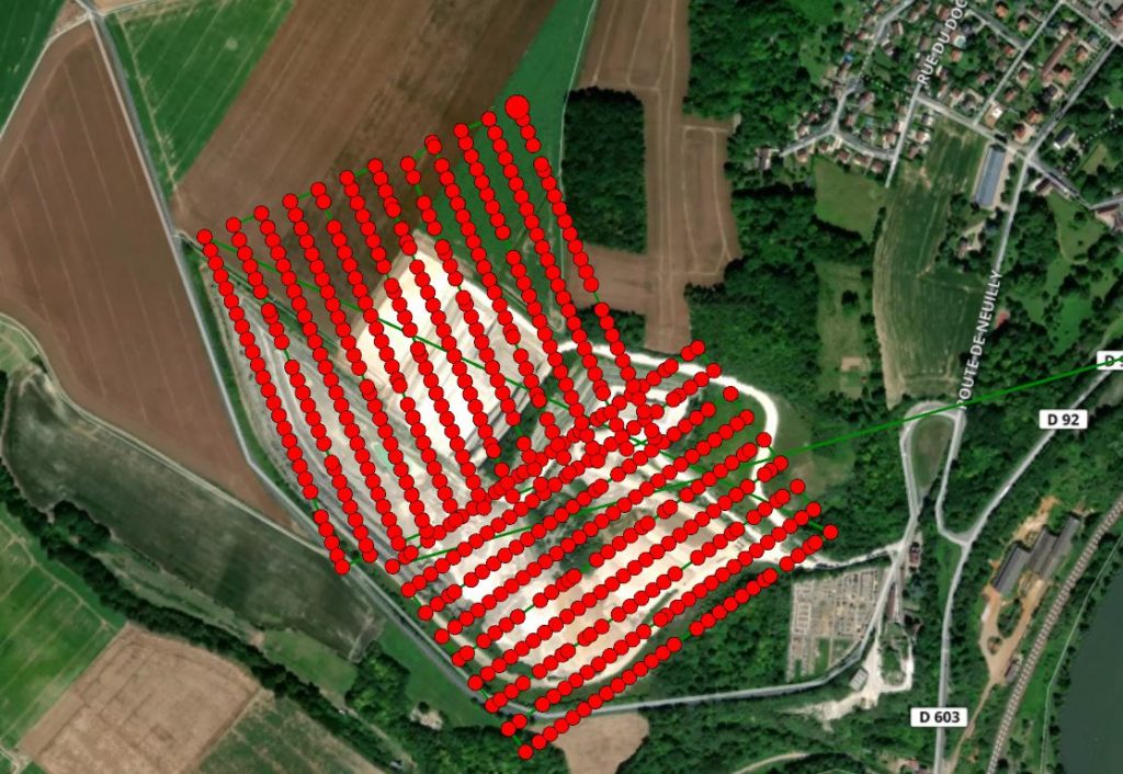
The drone scans a defined area under various angles during a planified and tailor-made flight path that covers the building, the construction site or any other areas in its globality, and collect precise data.
Once the data are collected, my softwares process them to reproduce buildings or monuments in 3D with an amasing accuracy.
We export 3D models under different formats for your specialised softwares : Autodesk, Collada, VRML, IPM, RZI, Obj, etc.